


June 2, 2013
William Duncan’s 1794 New-York directory with the Map intact
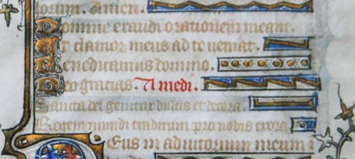
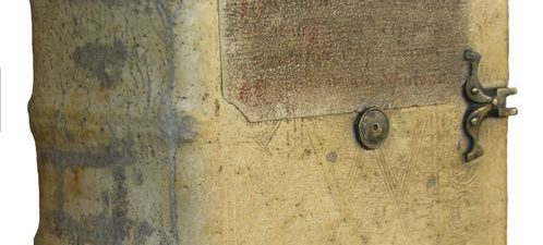
[EARLY NEW YORK HISTORY] [EARLY NEW YORK MAP] [EARLY AMERICAN DIRECTORY] Duncan, William. The New-York directory, and register, for the year 1794. : Illustrated with a new and accurate plan of the city and part of Long-Island, exactly laid down, agreeably, to the latest survey … New-York : Printed for the editor, by T. and J. Swords, no. 167, William-Street., –1794. Small 8vo., 16 x 10 cm., COMPLETE WITH MAP; i.e. xii, 288 p., [1] leaf of plates: 1 map. Some small loss to left margin of map as depicted, restorable tear to right margin, some general toning, a few folded corners, map detached. Early marble wraps partially preserved (and remarkably so), wraps detached, text-block without stitching (requires relatively easy resewing through the clean stab-holes present). Ref: Evans 26919. An EARLY NEW YORK CITY DIRECTORY OF GREAT RARITY, ESPECIALLY IN PRIVATE HANDS. $12,000
The Map present in this modest, ephemeral, and exceedingly rare directory is of great importance in American cartography. It was engraved by the well regarded early American engraver Cornelius Tiebout (1777-1832) after John McComb Jr. (1763-1853 ), one of the most important architects of the period. It was drawn primarily to depict the First Meeting of the Federal Government in New York. “The federal government under the new United States Constitution first met in Federal Hall (formerly City Hall) in New York City during the spring of 1789. This plan of the city of New York by John McComb (1763–1853) shows the city and environs and indexes many important landmarks, including Federal Hall.” [LOC]. Additionally, according to Evans, “In this directory is given the changes from the early names of the streets.”
There is a wonderful blog post by Philip Sutton on the importance of early directories to researchers, historians and genealogists (in connection with New York Public Library’s Direct Me NYC 1940 project) here.
Auction Record:
The only copy actually sold at auction in the last 30 years was in 1986 Swann Galleries for $650.00 (Thursday, April 3, 1986. lot 292) for an INCOMPLETE copy described as having “good portion of the engraved plan of the City and part of Long Island is lacking, tear at D2; lacks F5 and F6” Please keep in mind that the copy for sale here is COMPLETE by comparison with the important map intact!

